The boundary then follows the boundary of the existing Santa Cruz Purisima Formation Basin westward to a granitic outcrop. From there, the basin boundary proceeds southwestward along the spine of the granitic high. At the southern end of the Santa Margarita Groundwater Basin, the basin boundary follows the contact between the Lompico sandstone and the Locatelli Formation to its intersection of the Ben Lomond fault. The basin boundary follows the trace of the Ben Lomond fault north to the intersection of the Zayante Fault and the Ben Lomond Fault.
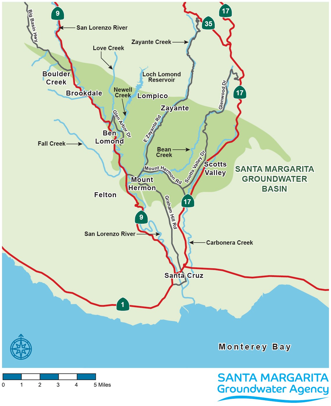
Geographically, the Basin includes the entire City of Scotts Valley, and unincorporated communities of Felton, Mount Hermon, Lompico, and Zayante. The Basin also includes the Eastern parts of the communities of Ben Lomond, Brookdale, and Boulder Creek.
The San Lorenzo River is the most significant surface water component of the Santa Margarita Groundwater Basin. The river runs in or near the western edge of the Basin; sub-parallel to the Ben Lomond fault. Important tributaries to the river in the Basin include Lompico Creek, Zayante Creek, Bean Creek, and Carbonera Creek. Loch Lomond is a man-made lake on Newell Creek, another tributary of the San Lorenzo River. The lake is approximately 2.5 miles long with a width of about 1,500 feet (McPherson and Harmon, 1998). The southern half of the lake lies within the proposed Santa Margarita Groundwater Basin. Loch Lomond is owned by the City of Santa Cruz, and water impounded in the lake provides a significant portion of the water used by the City of Santa Cruz.
Recognizing that the stacked aquifers defined a regional groundwater resource, a groundwater model of the area was developed in 1997 (Todd Engineers, 1997). The groundwater model has been regularly updated and used for groundwater planning purposes. Significant model updates occurred in 2006 (EITC, 2006) and 2015 (Kennedy Jenks Consultants, 2015b). The model was upgraded significantly in 2020 to meet the requirements of SGMA.